.jpeg)
Helping Tableau recognize UK postcodes
Tableau Tim from The Information Lab has some wonderfully informative and easy-to-follow YouTube videos about new features in Tableau 2020.2. But I hit one little snag while trying to follow along with his video on Tableau 2020.2 Set Controls.
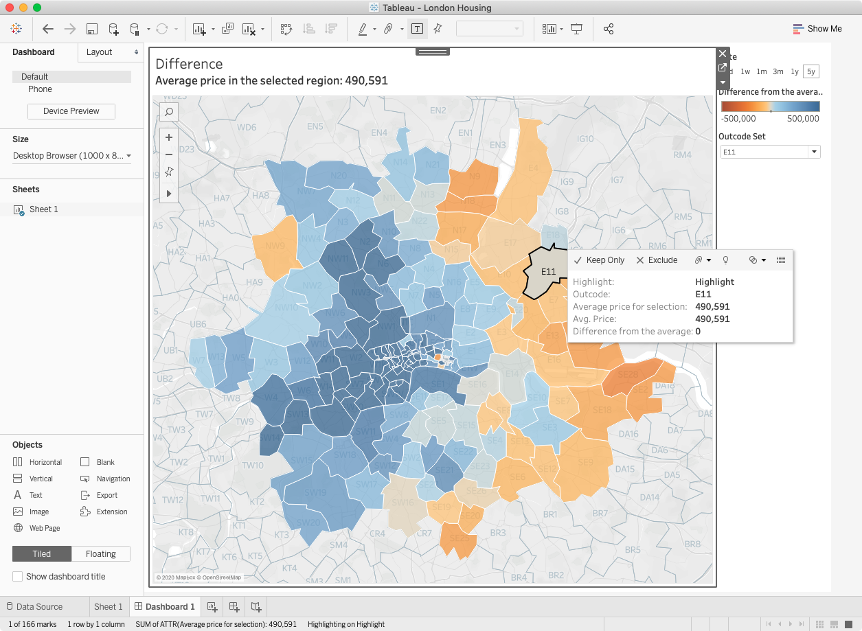
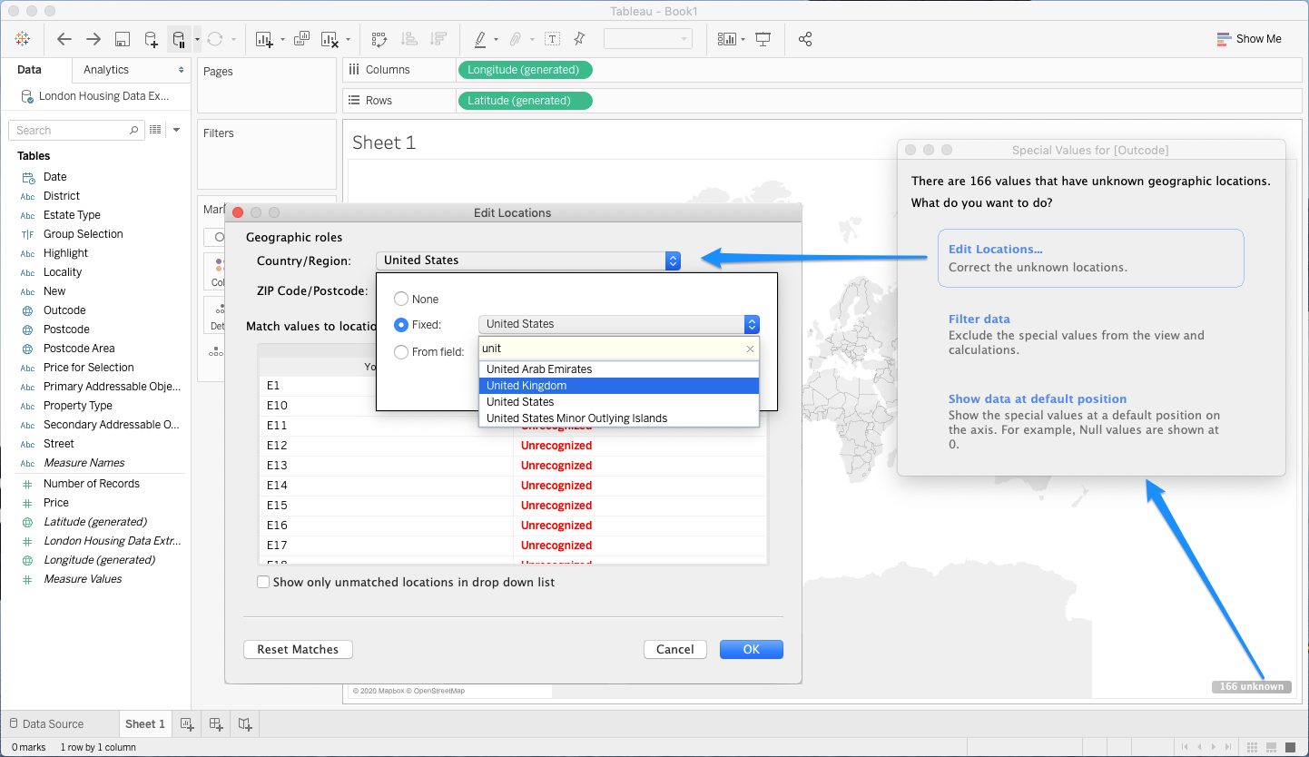
The Information Lab is based in the UK, so naturally their examples tend to be UK centric – in this case, visualizing the difference in housing prices in different post codes around London. Tim was able to assign the “Outcode” field in his dataset to the “ZIP Code/Postcode” geographic role to get Tableau to correctly plot them on a map. But when I did the same, Tableau would still not recognize the values.
As a US Tableau user, I found that I needed to give Tableau a little more help to recognize the values. I had to click “166 unknown” in the lower right corner, click “Edit Locations…”, then change my default geographic locale from United States to United Kingdom.
Once I did that, I was able to reproduce the rest of Tim’s lesson exactly!